
2023-10-05, 16:30–16:50 (Europe/London), EURAC Auditorium
Urban land use and surface properties play a major role in determining the quality of life for citizens and for urban planning. They have a strong impact alongside extreme events and phenomena, such as flash flooding due to heavy rains on a highly impermeabilized city, Urban Heat Island (UHI) intensification during heat waves, biodiversity reduction in green areas, etc.
To allow the study of such phenomena, high-resolution aerial and terrestrial data acquired with different sensors can be merged and processed with Machine Learning (ML) approaches in order to describe and predict the state of urban landscapes and create data-driven actionable insights.
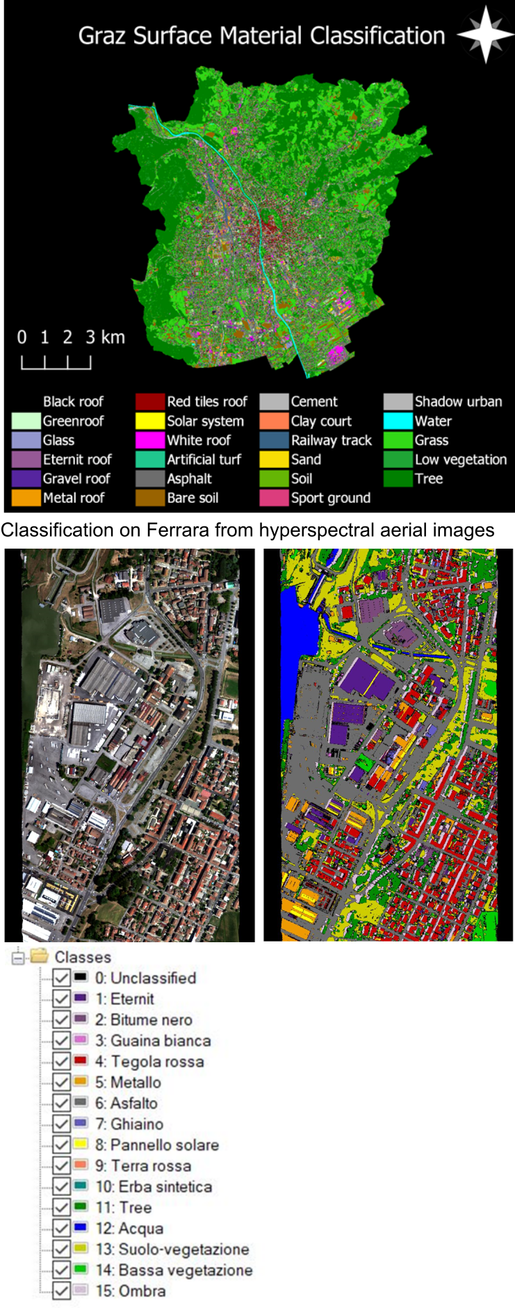
Within the USAGE - Urban Data Space for Green Deal - project [https://www.usage-project.eu/], this work investigates the integration of multi-source data in urban areas for environmental analyses. Two pilot cities are considered, Graz (Austria) and Ferrara (Italy), where multispectral, thermal, hyperspectral and LiDAR data were acquired from aerial flights.
Firstly, all multi-modal data were processed and co-registered in order to align them. Then, the proposed workflow uses aerial hyperspectral images to classify the surface material with ML algorithms (16-18 classes, normally), thanks to the availability of spectral information in the VNIR and SWIR ranges. The material properties are used to support the calculation of land surface temperatures (LST) from the aerial thermal images acquired in the LWIR range. The operation is critical in case of special materials, like metals, that originate false temperature values in the thermal images, given their low emissivity. As ground truth for the LST estimation, a series of ground measurements are performed during the thermal flights. The comparison of the temperatures measured on the ground and from the thermal camera underlines the influence of the atmosphere, and therefore the need of rigorous modeling for the correction of atmospheric absorption and scattering. The LST values derived from aerial thermal images are compared to those retrieved from Landsat TIRS images, in order to characterize the representativeness of the Landsat pixel over the urban landscape. Finally, the LiDAR point clouds can be enriched with the outcomes of the thermal and hyperspectral analyses for a more realistic and exploitable visualization of the territory.
The proposed workflow has been tested first on the data acquired on the city of Graz in 2021, then replicated and validated on the data acquired on the city of Ferrara in 2022. The proposed methodology could be replicated also in other similar cities to gain more insight from LST retrieved from Earth Observation data that are less resolute in space (~ 70 m) but guarantee higher revisit time, thus allowing for monitoring the evolution of the land cover within the urban environment.
Daniela Poli [AVT] d.poli@avt.at
Thomas Maffei [AVT] t.maffei@avt.at
Raniero Beber [FBK] rbeber@fbk.eu
Fabio Remondino [FBK] remondino@fbk.eu
Piergiorgio Cipriano [DEDA] piergiorgio.cipriano@dedagroup.it
Luca Giovannini [DEDA] luca.giovannini@dedagroup.it
Other

Geospatial data analyst at 3DOM research unit, FBK Trento, Italy
https://3dom.fbk.eu/people/profile/beber