2024-10-02, 12:00–12:45 (Europe/Lisbon), Raiffa Room (IIASA)
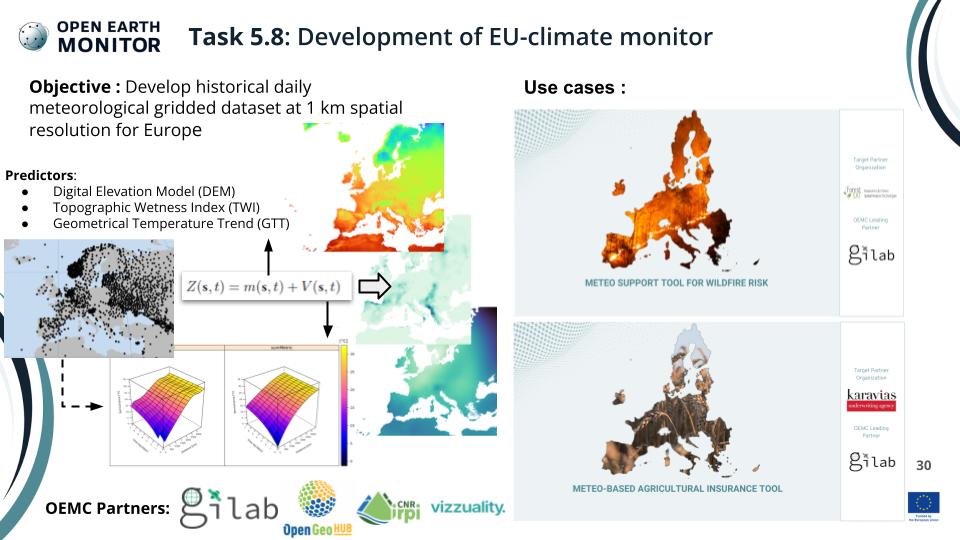
Daily gridded meteorological datasets are an important source of information for analysis of historical weather and many other research areas since they have no gaps in the spatio-temporal domain they cover. Most of the daily gridded meteorological datasets represent reanalysis or estimations from different remote sensing sensors or are generated by downscaling procedures. A daily gridded meteorological dataset for Europe at 1 km spatial resolution, named MeteoEurope1km, is created, covering the 1961–2020 period and consists of five variables: maximum (TMAX), minimum (TMIN), and mean (TMEAN) temperature, sea-level pressure (SLP), and total precipitation (PRCP). Spatio-temporal regression kriging, an interpolation method that combines multiple linear regression for trend modeling and space-time kriging for the estimation of the residuals, is used for interpolation of daily temperature variables. Ordinary kriging is used for SLP and PRCP, except that for PRCP an additional step to predict PRCP occurrence is applied using Indicator kriging. Combination of GHCN-daily, ECA&D, and SYNOP observations from OGIMET service is used as an observational dataset, with previous removal of duplicated stations and outliers. Geometric temperature trend, digital elevation model and topographic wetness index are used as auxiliary variables for temperature datasets. Accuracy assessment (leave-one-station-out cross-validation) shows high accuracy of the fitted models. Coefficient of determination for all temperature parameters and SLP is greater than 96%, while for PRCP is greater than 76 %. Root mean square error is 1.3°C, 1.6°C, 1.8°C, 1.5 mbar, and 2.5 mm for TMEAN, TMAX, TMIN, SLP, and PRCP, respectively. MeteoEurope1km is available as cloud optimized GeoTIFFs, and are accessible through dailymeteo.com portal, ZENODO, and R meteo package. Future work will be oriented towards increasing the spatial extent to other continents besides Europe, interpolation of other daily meteorological variables, and improving models performances by applying spatial machine learning methods, such as Random Forest Spatial Interpolation.
The workshop will be structured in two parts. The first part will be focused on the methodology applied, accuracy assessment, drawbacks and future plans. The second part of the workshop will focus on MeteoEurope1km data access and usage (COGs, ZENODO, QGIS, R meteo, Python, REST API, portal).
Open-Earth-Monitor Cyberinfrastructure (Grant agreement ID: 101059548)
Please provide URL that you plan to use to distribute your materials (if available). –Aleksandar Sekulić is a technical manager of GILAB DOO BEOGRAD and an assistant professor at the Department of Geodesy and Geoinformatics, Faculty of Civil Engineering, University of Belgrade. His main areas of expertise are: GIS, Geostatistics, Machine Learning, and modelling of spatial and spatio-temporal phenomena, with an application in spatio-temporal interpolation of meteorological phenomena.

